Thursday, March 31, 2011
Do You Know a VISTA?
My blog is read by so many people in so many places. I'm writing today to ask for help in spreading the word about VISTA Volunteers. Our College of Nursing and Health Sciences is looking for its third VISTA volunteer. This volunteer should have a background in dental hygiene, public health, nursing, or a highly related professional area. One large responsibility will be helping with the opening of a special dental health clinic which will be used by the dental therapists I described in an earlier post. Any one interested in learning more about VISTA may go to www.americorps.gov/about/programs/vista.asp or http://mncollegehealthcorps.wordpress.com
Wednesday, March 30, 2011
Views of the River
Yesterday my travels took me by an overlook where the Minnesota and Mississippi Rivers come together. The weather was sunny and encouraging, so I decided to stop and see the view with everything at flood stage.
 This area, logically enough, is called Two Rivers Overlook. The blocks and bricks in the overlook area display how the rivers join together.
 Inserted blocks help the walker understand better what is happening.


And this sign is often helpful.
 The plaque may help everyone understand better what is happening in this location.
 Directly across the river area from this over look in Fort Snelling. The first construction on Fort Snelling began in 1819 and the fort was completed in 1825. Sitting on a bluff over the junction of the rivers, the fort was in control of the transportation into the upper northwest of the U.S. territory. The fort remained in operation until after WWII.
The very oldest part of the fort is operated as museum by the Minnesota Historical Society. The visitor center there has a wonderful auditorium in which programs may be held about military history from a broad spectrum of time.
 Above is a view of the historical area of the fort.
 Above are the buildings of the fort using during WWI and WWII. They are falling into poor repair as it seems no one can figure out what to do with these buildings. The bridge in the view is the Highway 5 bridge across the Mississippi.
 Mostly what I saw yesterday was water. It was not really possible to see the two separate rivers. The area of the photo above with the white foam is the Mississippi, but I couldn't discern where the Minnesota was joining. The bridge is the background of this photo is the Mendota Bridge; it carries Highway 55 across the Minnesota River. It is a beautiful arched bridge. It was constructed in 1926, and at the time of its construction it was the longest concrete arched bridge in the world. The bridge is just about one mile in length and is the last bridge over the Minnesota River.
Mendota is a Dakota word for Meeting of the Waters, easy to see why this area has that name. There has been a small village in this area called Mendota since the early 19th century, and undoubtedly, the Dakota called their settlements in this area Mendota long before European and American settlers and soldiers arrived.
 Today I took a walk to see what the river was doing out the door. The flood mitigation plan for this area is to allow the river to spread into the opposite side of the river from which I live. Harriett Island is very much under water. The photo above comes from the Saint Paul web cam.
By looking at the bridge pier markings I could tell that the river has come up 15 feet since Saturday, March 19, in addition to spreading out a great deal in this area.
I found a place where the water was creeping over onto our side today.
 This is along a trail area about 2 blocks upriver from where I live. I found a man here throwing in a fishing line. I asked him if he really expected to catch anything. He said, "No, but I can't stand here and not throw the fishing line."
Much to my surprise a towboat came up river.
 Later the same tow boat came down the river. I finally though perhaps some workmen just decided they wanted to take a tour. They didn't pick up or leave anything on this trip.
The river chart tonight makes it appear we've seen the crest and that the river is falling just a bit. What happens for the next couple of weeks depends upon how fast the rest of the snow in Minnesota melts, and also what kind of rain or snow appears in the next couple of weeks.


And this sign is often helpful.


The very oldest part of the fort is operated as museum by the Minnesota Historical Society. The visitor center there has a wonderful auditorium in which programs may be held about military history from a broad spectrum of time.


Mendota is a Dakota word for Meeting of the Waters, easy to see why this area has that name. There has been a small village in this area called Mendota since the early 19th century, and undoubtedly, the Dakota called their settlements in this area Mendota long before European and American settlers and soldiers arrived.

By looking at the bridge pier markings I could tell that the river has come up 15 feet since Saturday, March 19, in addition to spreading out a great deal in this area.
I found a place where the water was creeping over onto our side today.

Much to my surprise a towboat came up river.

The river chart tonight makes it appear we've seen the crest and that the river is falling just a bit. What happens for the next couple of weeks depends upon how fast the rest of the snow in Minnesota melts, and also what kind of rain or snow appears in the next couple of weeks.
Monday, March 28, 2011
Flood News 6
Spoke too soon. The river is at 23.5 this morning, already now over 4 feet higher than the newly revised crest level of 19.2. Pictures later today.
Update: Hurrah --- the flood gauge must have been reading incorrectly for now several hours later the level is 18.5 with the crest of 19.2 still being expected. I knew as fast as I walked out to look at the river this morning, rather than looking at the flood gauge charts online that the river wasn't up to 23.5. I've very much learned what river level goes with how the piers appear on the High Bridge.
Update: Hurrah --- the flood gauge must have been reading incorrectly for now several hours later the level is 18.5 with the crest of 19.2 still being expected. I knew as fast as I walked out to look at the river this morning, rather than looking at the flood gauge charts online that the river wasn't up to 23.5. I've very much learned what river level goes with how the piers appear on the High Bridge.
Sunday, March 27, 2011
Celebrations
The past few days have brought moments of celebration. On Friday I went to the Dental Therapy and Advanced Dental Therapy Community Forum, featuring the first class of dental therapists to graduate from Metropolitan State University -- but more importantly, the first to graduate in the WHOLE United States. Starting the first of anything in the country is not an easy job, and many of my colleagues have worked very hard to make this a reality.
Why is such a program needed? Well the Pew Center on the States reports that 16 million children do not get dental care. That is like 3 Minnesotas! This obviously doesn't include disabled adults who can't get to a dental offices, elderly in nursing homes who need an adjustment in their dentures, or persons without dental insurance that simply can't afford dental care.
Dental therapists are found in nearly many other developed countries, but frankly the Dental Associations have always opposed the institution of this kind of dental health professional in the United States -- despite the fact many go with out dental care.
Through great work on the part of safety net organizations and skilled lobbyists, the law in Minnesota was changed in 2009 and the first class of students entered this graduate program. Early this year the Minnesota Board of Dentistry approved this program. That's what led to this celebratory forum held at Normandale Community College. The dental classes are held here because this community college has a dental clinic as well as specially equipped classrooms for preparing dental hygienists and now dental therapists.
The meeting room for this event was about as far as it could be from the parking lot and the door where one entered the buildings. The dental hygiene students decided to do something about this and we were all greeted this way:

Students in their blue shirts saying, "MnSCU makes history 2011" lined the way to the conference room. (MnSCU means Minnesota State Colleges and Universities.).
The room was lined with statements from the dental therapist students reflecting on their feelings after learning the Board of Dentistry has approved the program.


Among other speakers we heard Senator Al Franken.
 He was introduced by a dentist who met him at a coffee shop while he was campaigning. She asked him to do something about dental access, and said "One year later I was in Washington, D.C. testifying at a committee about dental access." Senator Franken spoke about the introduction of Dental Therapists into the Indian Health Service in Alaska. These first dental therapists in the IHS received their education in New Zealand.
The whole afternoon was just a wonderful time.
And before I arrived, I stopped by my tax office and signed my forms and got the good news that I'm getting a refund. The trick actually is to give away enough money, but I'd rather use it causes I care about than pay the money in taxes.
And today I got my usual emergency phone call at noon. The river is expected to crest in the middle of coming week at about 19.2 feet. I truly think it will be higher for as I write it is now gone over the 18 foot mark.

Either the crest is going higher or it will come sooner, but no longer it is it expected we will need to evacuate. Below is a picture from the web cam, a repeat of one I posted earlier. I thought the light was better in this one, taken today, March 27 just about sunset.

Tomorrow morning I plan to take a long walk and look at things again with my own eyes and camera.
Why is such a program needed? Well the Pew Center on the States reports that 16 million children do not get dental care. That is like 3 Minnesotas! This obviously doesn't include disabled adults who can't get to a dental offices, elderly in nursing homes who need an adjustment in their dentures, or persons without dental insurance that simply can't afford dental care.
Dental therapists are found in nearly many other developed countries, but frankly the Dental Associations have always opposed the institution of this kind of dental health professional in the United States -- despite the fact many go with out dental care.
Through great work on the part of safety net organizations and skilled lobbyists, the law in Minnesota was changed in 2009 and the first class of students entered this graduate program. Early this year the Minnesota Board of Dentistry approved this program. That's what led to this celebratory forum held at Normandale Community College. The dental classes are held here because this community college has a dental clinic as well as specially equipped classrooms for preparing dental hygienists and now dental therapists.
The meeting room for this event was about as far as it could be from the parking lot and the door where one entered the buildings. The dental hygiene students decided to do something about this and we were all greeted this way:

Students in their blue shirts saying, "MnSCU makes history 2011" lined the way to the conference room. (MnSCU means Minnesota State Colleges and Universities.).
The room was lined with statements from the dental therapist students reflecting on their feelings after learning the Board of Dentistry has approved the program.


Among other speakers we heard Senator Al Franken.

The whole afternoon was just a wonderful time.
And before I arrived, I stopped by my tax office and signed my forms and got the good news that I'm getting a refund. The trick actually is to give away enough money, but I'd rather use it causes I care about than pay the money in taxes.
And today I got my usual emergency phone call at noon. The river is expected to crest in the middle of coming week at about 19.2 feet. I truly think it will be higher for as I write it is now gone over the 18 foot mark.

Either the crest is going higher or it will come sooner, but no longer it is it expected we will need to evacuate. Below is a picture from the web cam, a repeat of one I posted earlier. I thought the light was better in this one, taken today, March 27 just about sunset.

Tomorrow morning I plan to take a long walk and look at things again with my own eyes and camera.
Saturday, March 26, 2011
A Look at the River -- with the web cam
If anyone wishes a look at the Mississippi River now at major flood stage in Saint Paul, go to www.stpaul.gov/floodprep
At the bottom of the page there is a web cam with a photo changing very 30 seconds. If you see a what looks like white grain elevator now almost sitting in the river with a bridge behind it, you are getting a view from my neighborhood.
 Update on Sunday, March 27. I did get a picture copied from the web cam. This is a view up river. The bridge in the back is the High Bridge, one I've shown many times. The buildings along the right side of the river are where I live.
At the bottom of the page there is a web cam with a photo changing very 30 seconds. If you see a what looks like white grain elevator now almost sitting in the river with a bridge behind it, you are getting a view from my neighborhood.

Thursday, March 24, 2011
Flood News 5
Despite the idea that snow was good, the Mississippi is coming up high fast!
 It has come up one foot since noon today. And compared to yesterday at noon it has risen by 3 feet. I noticed this afternoon at 5 PM that the trees on the opposite side of the river on Harriett Island are beginning to be in the water. Pictures tomorrow!

Wednesday, March 23, 2011
Spring is just a six-letter word

The good news is that the moisture came as snow. It's just going to sit there for a bit. The temperatures for the next few days are just at freezing, so there won't be any quick melting.
Every day at noon now I get a phone call from the emergency center. At noon today the river depth was at 10 feet.

And the title of this entry is not original. It comes from an article in today's Pioneer Press.
This is the kind of snow that arrived every week in Pecs last year. I thought spring would never arrive, but it finally did, and I'm sure we will see it too.
Monday, March 21, 2011
River View
I took a short walk about 11 AM to see what was happening along the river. It was easy to see that it is rising.
But this picture makes it look so beautiful and benign.
 This is a reflection of one of the bridge piers on the High Bridge.
And if you ever wondered how the official levels are measured, here's the answer.
 This is a United States Geological Survey station. It is a few feet up river from the high bridge. There is a cable that extends down into the river from the station. I noticed the cable is in much better condition that it was just a few weeks ago. Someone had the fun of working along the cold winter in February getting it updated for measuring the flood.
But this picture makes it look so beautiful and benign.

And if you ever wondered how the official levels are measured, here's the answer.

Sunday, March 20, 2011
Flood News 4
Here's the new graph of the river level. It's coming up!
 Today the weather was fog and light drizzle, not very pleasant, but much better than a rain storm. However, while shopping I overheard someone speaking about how the wind blew and the rain came down last night, so I apparently slept through something!
Update: Monday morning -- the river is now at 7 feet, continuing to rise overnight. I took a short walk and could easily see from usual landmarks that the river is rising. Ice flows continue to go down river, too. Today, thankfully is dry, so a lot of water is moving south without any being added.
Saint Paul set up traffic markers this morning to shut down the Shephard Road, the main road outside my apartment. Glad I don't have to go anywhere early tomorrow morning. Despite the announcements in the news for the last several days, I'm sure many drivers will be surprised and the morning rush hour will not be pretty!
Other Signs of Spring
My blog has been full of flood news, but there are other signs of spring and scenes that should be noted.
The snow melt this week has been quite tremendous. The temperatures have stayed above freezing at night, so when the sun returns each day, the snow continues to melt.
 Here are some landscape rocks emerging from snow banks. One almost forgets what is under the snow, and scenes like this are a surprise.
On Friday I had to make a trip to Normandale Community College. The people with whom I needed to work have a conference room with one of the best views in town.
 This college setting includes a Japanese Garden. It looks particularly scenic on a sunny day.
Here are photos showing more detail from the Garden.


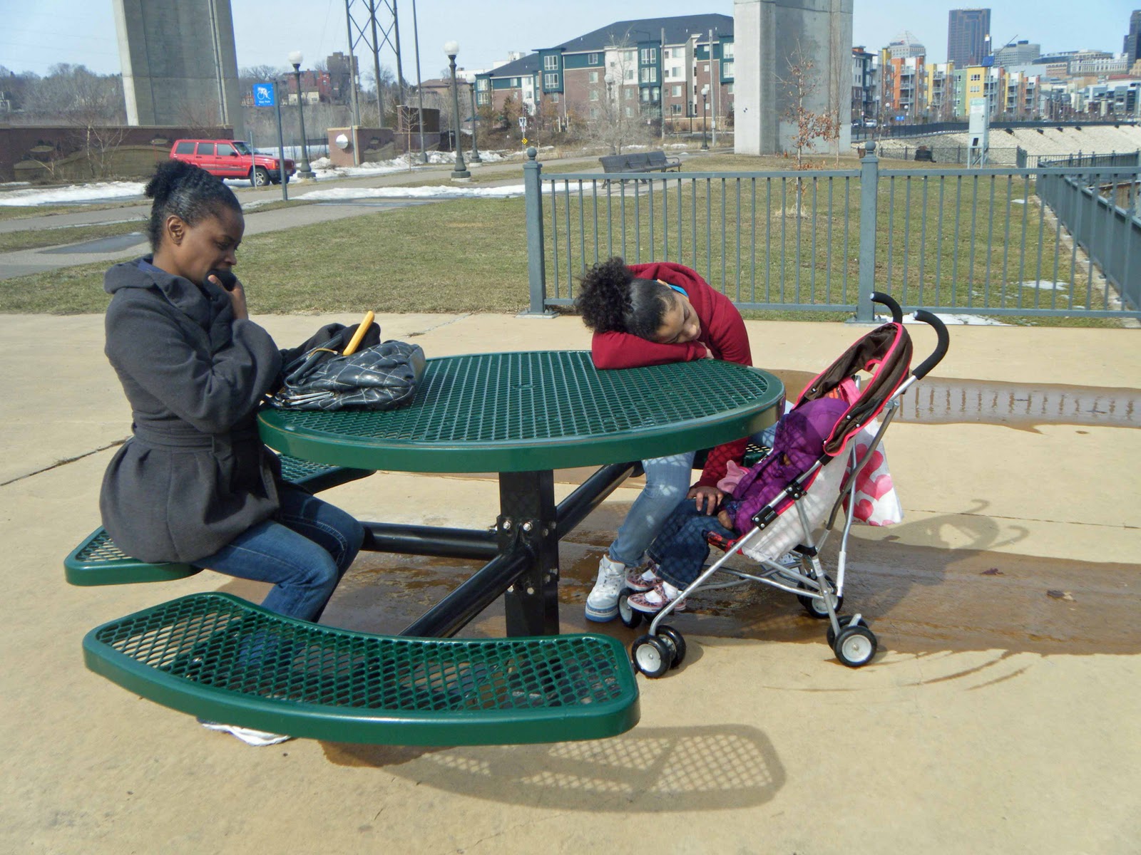
On Thursday my daughter gave me nearly a month's laundry from her family. She doesn't have any laundry services in the building in which she lives and I've been doing it for her, but this was quite a huge job -- 3 loads of jeans among other things!
They all came over on Saturday afternoon to pick it up (and even left more). We took a short walk along the river.
 It is easy to see that a lot of the snow has disappeared. This photo comes from an overlook along the river just beyond the high bridge. It's about a 5 minute walk from my apartment. My granddaughter certainly was not acting like herself. She stayed behind with me for a few hours and worked on the additional laundry while I went out for some errands. I finally found out she had not gotten home until midnight, after being out with friends to the movies, and then the little sister got everyone up at 7 AM and was a whirlwind of activity until she finally dropped off to sleep on the drive over. It's not easy being nearly 15 with a nearly 2 year old sister!
The snow melt this week has been quite tremendous. The temperatures have stayed above freezing at night, so when the sun returns each day, the snow continues to melt.

On Friday I had to make a trip to Normandale Community College. The people with whom I needed to work have a conference room with one of the best views in town.

Here are photos showing more detail from the Garden.


On Thursday my daughter gave me nearly a month's laundry from her family. She doesn't have any laundry services in the building in which she lives and I've been doing it for her, but this was quite a huge job -- 3 loads of jeans among other things!
They all came over on Saturday afternoon to pick it up (and even left more). We took a short walk along the river.
Saturday, March 19, 2011
Flood News 3

I close with a picture taken the from opposite side of the river from where I live. This comes from the KARE-11 website.

Wednesday, March 16, 2011
Flood News 2
Here is a video about flood preparations. I am sharing it mostly because the bulk of the video was shot "out the door" from where I live. This gives you all on the other end of the computer a good idea of what I see when I head out for a walk.
Today our building hosted a flood preparation meeting for building managers. We all found a mailing from the city in our mail boxes about upcoming planning meetings for residents, including one that will have Somali translation since so many who live in the second building away from me speak that language.
My walk this afternoon shows the river still at the same depth as yesterday. A lot of snow in the immediate area is melting and the storm sewers are busy dumping water in the river. Whew! That much on its way south.
Flood News 1

Tuesday, March 15, 2011
Spring Break -- Day 2
I started the day by going to EPCOT. The Flower and Garden Show has just started at EPCOT so there are many floral pieces to see. I began by taking the ride through Spaceship Earth. Then I went to the Land pavilion and got a Fast Pass for Soaring. It was for about 3 hours in advance so the next thing I did was do the ride through the gardens. There are always some new things -- or things I don't remember here.
Here is one way to grow lettuce:
 I had breakfast and then still had time so I went over the Seas Pavilion. Here I especially enjoyed watching the seahorses.
 Finally got the Soaring ride and it was awesome as always.
From there I went to the ride in Imagination. I'm still one of the visitors who think the original ride was much better. WDW had to agree with the controversy and bring back Figment.

I also saw a TV clip being prepared. I don't know where it did or will end up. The woman in the blue shirt is explaining how to make a topiary. Not only does it have to look good the first day, but it also has to accommodate the growth of the plants while the topiary is on display.
 Here is a topiary of Beauty and the Beast found at the French Pavilion.
 I went into this area because I had a reservation for lunch at Les Chefs de France. This is one of my favorite restaurants. I had lobster bisque, Quiche Lorraine, and creme brulee, along with a wonderful glass of Merlot.
I wandered over to the boat to Boardwalk and sat in the hotel lobby for awhile and read. I had done a lot of walking and my feet were complaining! After a rest I took a bus to the Magic Kingdom and then got the bus from there back to my resort.
But first before I end -- a beautiful spring image:

Here is one way to grow lettuce:


From there I went to the ride in Imagination. I'm still one of the visitors who think the original ride was much better. WDW had to agree with the controversy and bring back Figment.

I also saw a TV clip being prepared. I don't know where it did or will end up. The woman in the blue shirt is explaining how to make a topiary. Not only does it have to look good the first day, but it also has to accommodate the growth of the plants while the topiary is on display.


I wandered over to the boat to Boardwalk and sat in the hotel lobby for awhile and read. I had done a lot of walking and my feet were complaining! After a rest I took a bus to the Magic Kingdom and then got the bus from there back to my resort.
But first before I end -- a beautiful spring image:

Spring Break -- Day 1
 |
| Midnight March 7 |
 | ||
| Port Orleans -- French Quarter Resort at Disney World |
And speaking of features -- I found some Mouse Ears on a bed:

French Quarter is a take-off on New Orleans.

My first evening I took the boat to Downtown Disney.

 |
| Did your Tinker Toy set stand 10 feet high? |
Sunday, March 6, 2011
Mundane March
The heading on my blog mentions the word, mundane, and indeed the past few days have been mundane. We continue to be covered with snow and just can't get the temperature above freezing to melt it. I've kept my nose glued to the computer reading students' papers and being disappointed at the quality of some of them. The least of this disappointment is that if the poor papers are re-written I have to read them again.
Here are some snow visions:
 This is a snow bank outside my building, made bigger by pushing snow up from the street.
Here's another one -- a bit more scenic:
 I also found this view while walking around:
 In the midst of the mundane and blah, we got hit with a detour. Obviously trains used to come into the Union Depot or it wouldn't be called that. Then in the 1970s when everything had to be made more modern, the idea came to build a small new building about the borderline of St. Paul and Minneapolis and that is where the Amtrack has stopped since then. This is one of those non-descript 1970s could be anything buildings, and located in an area of small office buildings, quite out of the way of anything interesting. I much prefer the grand old train stations I've found in Central Europe even if some are in poor repair. One knows it is a train station.
Now the plan is to refurbish the Union Depot back into a transit hub. The light rail will end there, bus routes will start and end there, other passenger rail lines will come into this space. This means building the rail line back into the depot.
Readers know that I live along the river and that most of Saint Paul is up on a bluff. There are two ways to get there. On Eagle Street one must cross the train tracks, on Sibley Street one goes under the train tracks -- much preferable because auto traffic and car traffic can move at the same time. Sibley Street, however, closed on March 1 and the only way to get up into the city is now Eagle Street, across the train tracks. Closure of Sibley allows the spur line to be built to move the trains again into Union Depot.
Here's a view out my window of rush hour when a train is moving:

The line of stopped traffic went back at least a mile. It takes awhile to clear as well, for only 3-4 cars can move on the left turn light to go up the hill into the downtown area. This is made a bit more difficult right now, because we are in the midst of March Madness. March Madness is the high school tournament season when every weekend during March there is some type of high school state athletic event. This brings extra traffic right into this area, and lot of that traffic are people who don't know the area very well.
Work began immediately the day of the closure. I can see some of the work on the downward drive to the river, for I can still use the parallel street to Sibley to come home. There is huge construction equipment in the area already doing demolition. Some day when the weather is more favorable, I'll take a long walk and do some photos.
This detour goes until at least August 1. With all my summer travel plans I will miss a lot of this! And we probably would have lost that area too during April when the floods hit. That area is a bit lower than where I live and so is always closed and sand bagged so that river water can not run up the hill and flood the downtown area.
The question about floods now is not whether it will happen, but rather how far up on the all time high floods this one will go.
Here are some snow visions:

Here's another one -- a bit more scenic:


Now the plan is to refurbish the Union Depot back into a transit hub. The light rail will end there, bus routes will start and end there, other passenger rail lines will come into this space. This means building the rail line back into the depot.
Readers know that I live along the river and that most of Saint Paul is up on a bluff. There are two ways to get there. On Eagle Street one must cross the train tracks, on Sibley Street one goes under the train tracks -- much preferable because auto traffic and car traffic can move at the same time. Sibley Street, however, closed on March 1 and the only way to get up into the city is now Eagle Street, across the train tracks. Closure of Sibley allows the spur line to be built to move the trains again into Union Depot.
Here's a view out my window of rush hour when a train is moving:

The line of stopped traffic went back at least a mile. It takes awhile to clear as well, for only 3-4 cars can move on the left turn light to go up the hill into the downtown area. This is made a bit more difficult right now, because we are in the midst of March Madness. March Madness is the high school tournament season when every weekend during March there is some type of high school state athletic event. This brings extra traffic right into this area, and lot of that traffic are people who don't know the area very well.
Work began immediately the day of the closure. I can see some of the work on the downward drive to the river, for I can still use the parallel street to Sibley to come home. There is huge construction equipment in the area already doing demolition. Some day when the weather is more favorable, I'll take a long walk and do some photos.
This detour goes until at least August 1. With all my summer travel plans I will miss a lot of this! And we probably would have lost that area too during April when the floods hit. That area is a bit lower than where I live and so is always closed and sand bagged so that river water can not run up the hill and flood the downtown area.
The question about floods now is not whether it will happen, but rather how far up on the all time high floods this one will go.
Subscribe to:
Posts (Atom)